

Route Overview
| Distance | 36 miles |
|---|---|
| Surface | The route has an unsealed surface almost throughout, and can get muddy after rain. It also floods in places, after periods of sustained rain. |
| Difficulty | Moderate |
| Child-Friendliness | 🟡 Somewhat child-friendly |
| Suitable Bikes | Anything (including trikes) |
| Barriers | There's a single barrier, and even trikes should be able to easily get through. |
| Café / Food | There are quite a number of cafés along the route. See further below for more detail, and a few links. |
| Train Access | The nearest station is Shalford, but along the route there's also the stations at Christ's Hospital, Horsham, and Shoreham-by-Sea. Just read my Bikes On Trains guide 1st (link further below). |
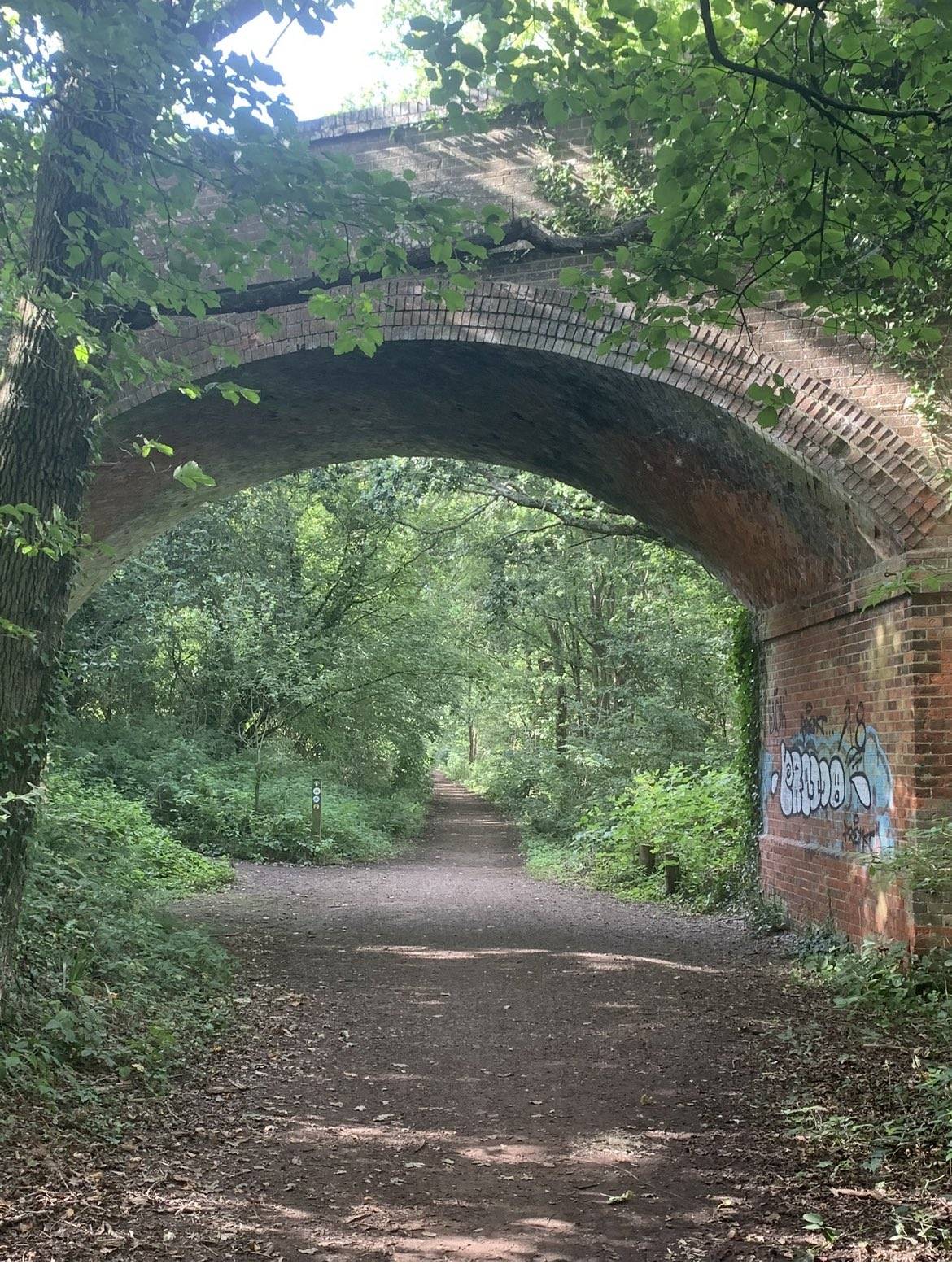
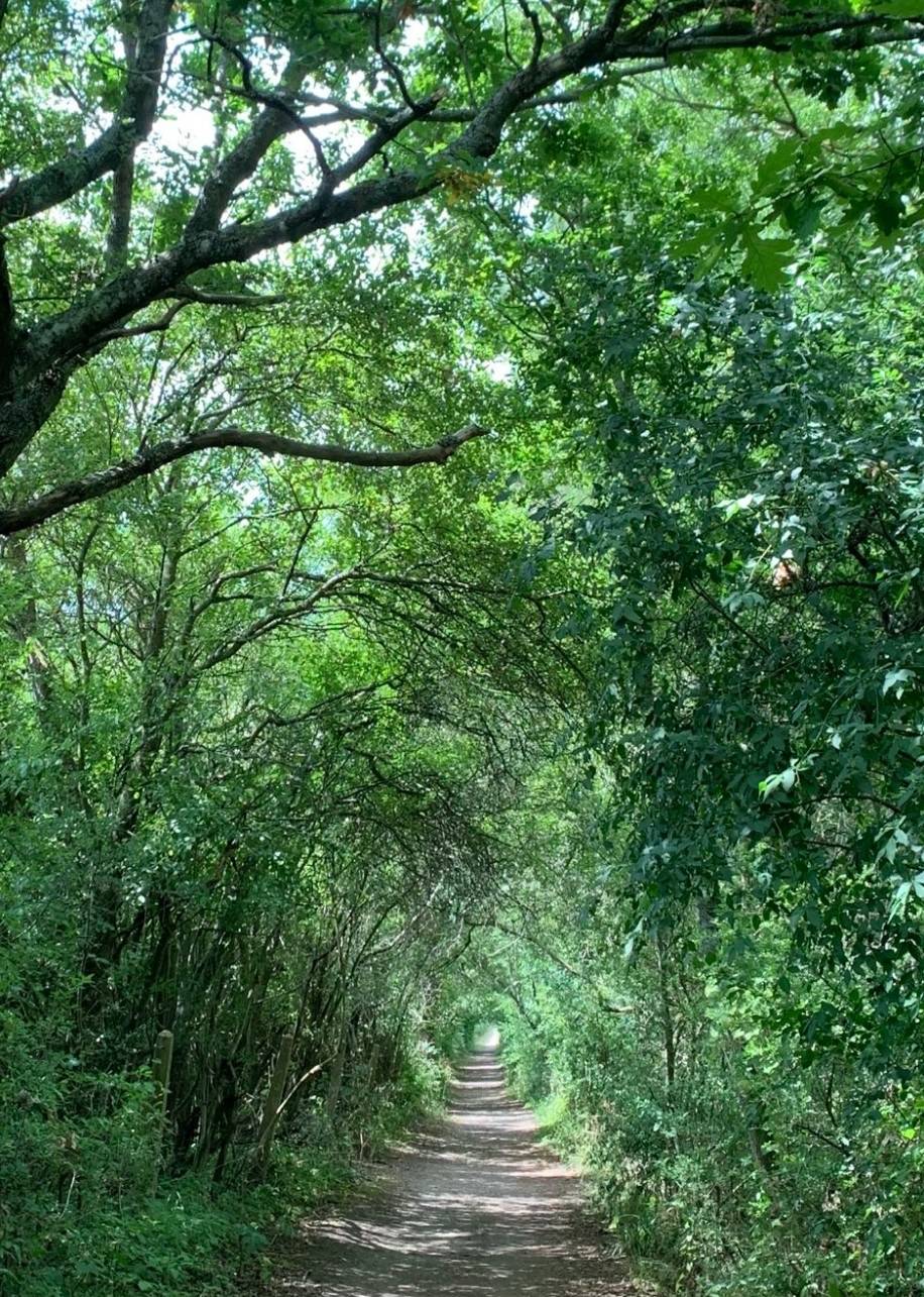
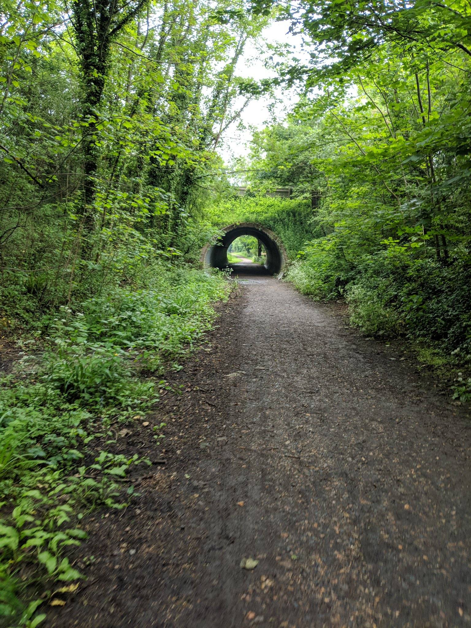
The Downs Links is 36 miles of almost completely traffic-free cycling bliss. Built primarily on the route of a disused railway, most of the route is very flat, though there are a few paces where you’ll be faced with inclines that may be steeper than you’d like.
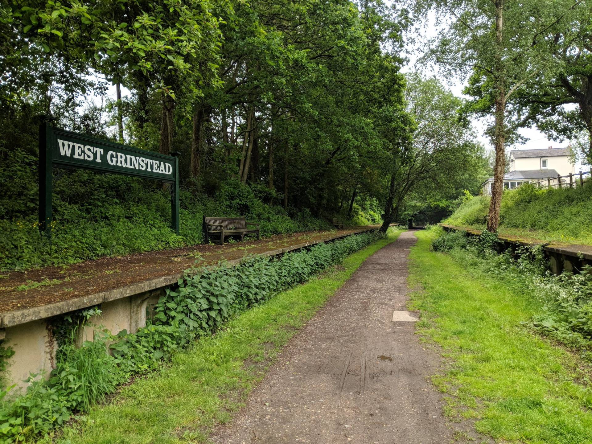
The Downs Link officially starts in Guildford, and runs to Shoreham-on-Sea. The route shown on the map below starts at Shalford, Surrey, and the reason for that is simple: cycling out of Guildford you will either have to contend yourself with busy roads, or a segment of trail where there are many steps, down which to drag your bike.
Shalford has a train station, but before taking your bike on the train, be sure to read my Bikes On Trains guide first.
Please note that there are a few on-road segments. South of Southwater you’ll encounter the first, with the most unpleasant probably being the third of a mile onlong the B2135, south of Partridge Green. There is a very narrow pavement you may want to choose to cycle on instead.
You can easily combine this route with both the Thames Path and the Wey Navigation, allowing for mostly traffic-free cycling from the heart of London to the sea.
Photos by DiminutiveFox, Andy Keetch and SolOnWheels.
Downs Link cycle route overall rating:
(Colour explanation: blue = good, yellow indicates some warning, and red indicates issues to be aware of)


Surface on the Downs Link
Most of the route is on self-compacting gravel, and is rideable all year round. However, after rain, and especially in winter, you will want mudguards.
In winter there are usually some segments that either floods, or are covered in deep mud.
Refreshments
There are a surprising number of cafés along the route, though some are just off the route. Be sure to tick the café tick-box on the map, to see where they are.
Seven miles in, there are several in Cranleigh (some on-road cycling needed). At 11 miles, The Milk Churn is off the trail, but nearby. 18 miles in, you have more options in Southwater, again off the trail. After 24 miles, at Partridge Green, Mary’s is basically on the trail. Finally, there are cafés in Shoreham.
Bikes
Practically any kind of bike can be used on the route, but bikes with fatter tyres and mudguards will be better.
Toilets
There are toilets in Shalford, in Cranleigh (but off-trail), at The Lintot pub in Southwater, at the Southwater Country Park Café (off-trail), at The Old Railway pub in Henfield, and in Shoreham-by-Sea.
Safety from traffic
While there are some on-road sections, they are mostly on quieter roads. The exception is a short stint just south of Partridge Green, where there is a narrow pavement.
Points of Interest
For starters, you’ll be cycling to the beach. Also look out for Bramber Castle, a ruined Norman fort.
Routes in Sussex
- Brighton Bimble – finally done!
- Centurion Way traffic-free cycle route
- Downs Link Traffic-free Cycle Route
- Cuckoo Trail Traffic-free Cycle Route
Barriers
There’s one barrier just north of Southwater, but trailers at least should be able to get through easily, as should trikes.
There are several gates along the route, and people on adaptive bikes, who cannot dismount, will struggle with those.
In places, the trail is quite narrow, and you may find yourself needing to stop when encountering others using it.
Cycle Hire
Bike hire is available from Southwater Cycles.
Child friendliness
Overall, the route is very child-friendly, though there are some sections (particularly the on-road stretches) that would be entirely unsuitable for especially younger children.
Social safety
Much of the route is along very isolated stretches, when there can be few people around.
Hilliness
The route is mainly very flat, and is a nett downhill to the sea, but there are a few little climbs to contend with.
Forecast for the Downs Link

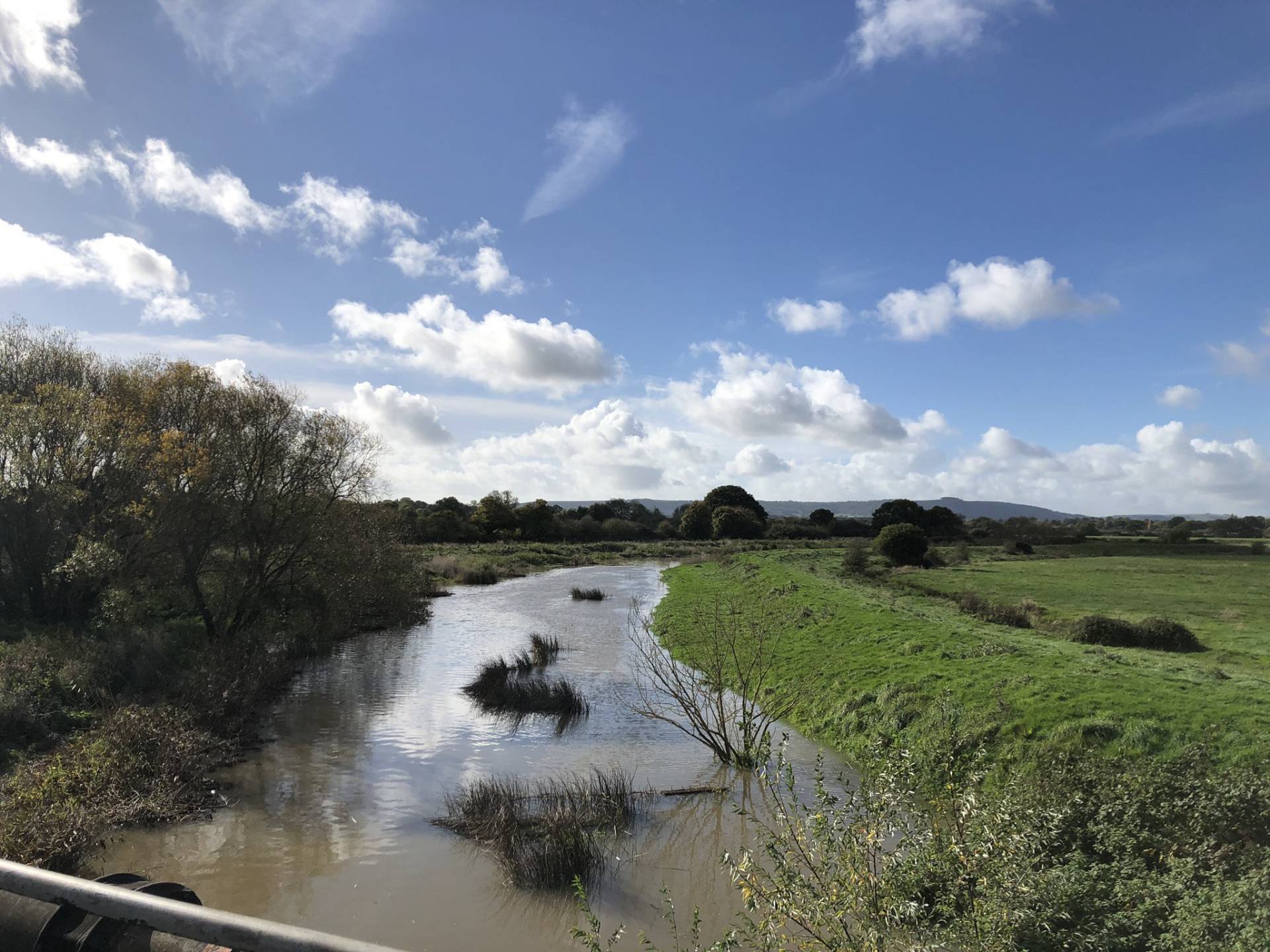
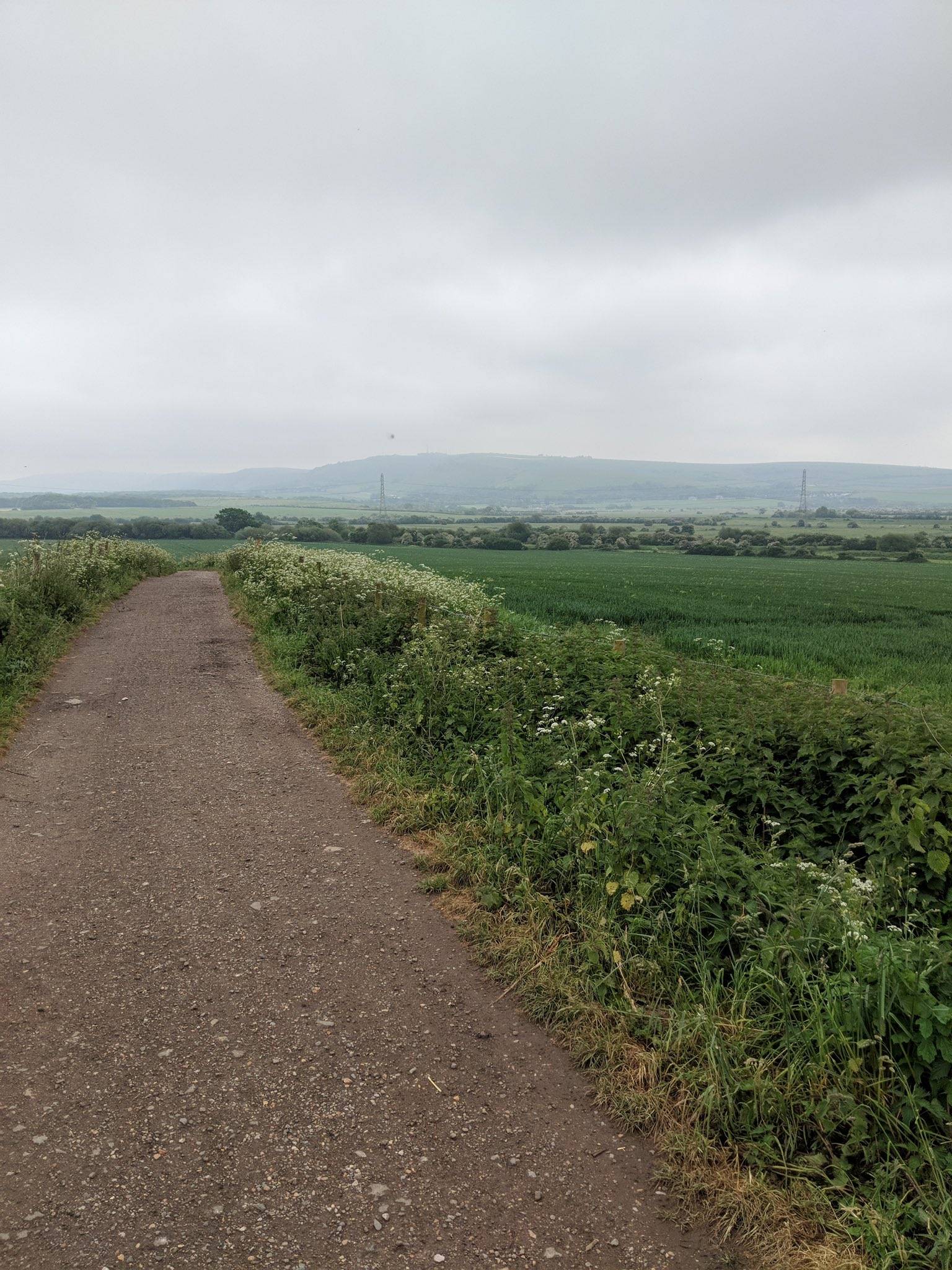
What the Downs Link looks like
Getting to the Downs Link
This is a great car-free day out from London. Simply get the train to Shalford, and cycle down to the sea. Other stations along the route are Christ’s Hospital, Horsham and of course Shoreham-by-Sea. Do yourself the favour of first reading my Bikes On Trains guide though.
More Routes
To find more routes, click this link.
Interactive map for the Downs Link
You can download the GPX file from the map below, simply by clicking the GPX button. Hovering over the elevation profile will show the elevation for that point along the route, in both metres and feet. It will also show the gradient.
If viewing the map on your phone, you will also see a Find Me, Navigate and Record Route button, below the map. WillCyclers can have voice turn-by-turn navigation of the route, and participate with any treasure hunts that may be active along the route.
And finally…
If this route guide was of use to you, it will be of use to others, too. Don’t keep it secret! Share it with everyone, on social media, in Facebook Groups, on chat forums, and elsewhere.
It’s a lovely ride, even with a bit of road work, and I enjoyed your write-up. I can add that The Cabin just south of Henfield (on the trail) now has toilets (in addition to nice coffee, cakes and splendid views) and the Henfield to Bramber stretch has a couple of short but “interesting” inclines/decents on a badly made farm track that includes loose stones. Please take care on those sections – I have seen people come a cropper there.
Thanks for the update, Robin
Hi Will, a quick update on the Bramber to Henfield section. The local authorities have carried out some improvements to the worst sections and re-surfaced them. It’s not perfect and care should still be taken, but it is a lot better.
Seconded the advice r.e. Henfield-Bramber. It’s a bit of a shock after the miles of flat! Similarly, but not as bad, there is a stretch just north of Rudgwick/Cox’s Green (mile 10 on your map) where the path is diverted to avoid a (currently?)-unusable railway tunnel and instead goes sharply up and down with an uneven dirt surface. Finally: I did the southernmost stretch on a scorching day this summer and was gratified to find a water fountain just off-trail in a layby off the A283 just south of Bramber.
Great site, good luck!
Thanks for the update, and your kind words, David.
I lived in Southwater for a while, about 30 years ago, and rode the section to Partridge Green, where we had family, a few times. In those days it seemed to often be very muddy and not much fun on skinny tyres. I wasn’t a regular cyclist then and it never occurred to me to ride to the coast, or to head north. Maybe I’ll have to do it one day, although I don’t have much reason to visit that part of the world these days.
Sorry, this is no help to anyone, just reminiscing…
Just did the route yesterday, south to north, returning in a couple of days. The section north of Rudgewick your other respondent comments on is **much** worse than the bits near Bramber. Really steep, really poor surface with gullies and loose material. The only section of the route I got off and pushed, and even that (with full panniers after riding from Brighton) almost finished me. The surface is so poor I won’t ride down it even, too treacherous. I’m looking for a detour. Not sure if this is a temporary diversion but for now it changes the whole grading of the route from ‘fine’ to ‘punishing’.
Thanks very much for that update, Sven!