Discover the UK’s best traffic-free cycle routes
Below are some of the most recent route guides, but be sure to visit the UK-wide map, showing all the route guides. All routes have a custom WillCycle map, from which you can download the GPX for the route, and where you can see the route profile in detail.
The route guides include an up-to-date weather forecast, and lots of information about the route. It even tells how how long it would take to cycle, at your preferred speed.
Featured routes
These are just some of the stunning routes I have highly-detailed guides for. Refresh the page to see more routes.
Even more value
WillCycle Supporters gain even more value, including achievement badges, and more, as well as Strava integration.
These route guides are all made with 🚲 in Devon.
Latest from the blog
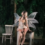
- Fairy Trails
 Do you ever go cycling, or walking, with young kids? What if I told you that you could easily add a bit of magic to those outings? How? By doing Fairy Trails! Fairy Trails are being embedded into more and more of the traffic-free cycle routes listed on WillCycle. To play, simply visit the route … Read more
 - Treasure Hunt: A Cycling Adventure You Can’t Plan ForSomewhere along some of WillCycle’s traffic-free routes, there are stickers hidden. Those were been placed there deliberately, in a spot that requires effort to reach. It won’t appear on any map. Nobody is going to tell you where it is. And the first WillCycler to find it and send proof will have their first name … Read more
- Why one map is never enoughWe’ve all been there: you planned a glorious route for a bike ride. You checked OS Maps and confirmed it’s a bridleway that you may legally use. You planned a 50 mile loop, using that bridleway to avoid a nasty, busy A-road. Then you arrive, and that “legal right of way” is a chest-high sea … Read more
- Lanterne Rouge RideIn the Tour de France, the Lanterne Rouge is the rider who finishes dead last. They are the survivor, the tail-light in the dark, and if we’re being honest, the person who probably had the most interesting day. While the hardcore roadies are busy staring at their power meters and sweating through their Lycra to … Read more