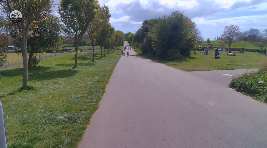
Bay to Bay Multi-use path

Penzance to Marazion cycle path The Bay To Bay Multi-Use path runs from Penzance station to the edge of Marazion, some 2.3 miles away. The path was built in 2022, using smashed concrete from the Penzance promenade as sub-base. The path runs along the coastal flood defences, and is sandwiched between the railway line, and … Read more

Tarka Trail – Barnstaple to Braunton

The Tarka Trail is simply stunning, and this section is exceptional, in so many ways. With glorious views over the incredible Taw and Torridge estuary, the route offers waterside tranquillity, mixed with rural, traffic-free bliss, along a disused railway. There are a number of cafés along the route, from the start at the Barnstaple train … Read more

Tarka Trail – Ilfracombe to Willingcott

The Tarka Trail offers some of the very best traffic-free cycling available in the UK. This 3.5 mile segment is disconnected from the rest of the Tarka Trail though. Starting adjacent to the site of the old Ilfracombe railway station, the route follows the track of the old Ilfracombe branch of the London & South … Read more

Great Central Way – Leicester to Cossington

This route guide actually covers more than just the Great Central Way, and includes some towpaths, and other traffic-free paths, to extend the route to 11.7 miles, ending in Cossington. It makes for a gorgeous, almost entirely traffic-free day out. Great Central Way cycle route overall rating: (Colour explanation: blue = good, yellow indicates some … Read more

Chiseldon to Marlborough Railway Path

This scenic 7.7 mile path mostly follows the track of the old Midland and Southwestern Junction Railway, linking Chiseldon and Marlborough. It’s a shared path, and also a bridleway, so expect to encounter horses at times. Chiseldon to Marlborough Railway Path cycle route overall rating: (Colour explanation: blue = good, yellow indicates some warning, and … Read more

Brighton Bimble – finally done!

Brighton Pier

So, you’re based in, or near London, and you’re looking for a great, ready-made, two or three day cycling adventure? Oh, then I have really good news for you!

Slough Arm of the Grand Union Canal

Slough GUC cycle route overall rating: (Colour explanation: blue = good, yellow indicates some warning, and red indicates issues to be aware of) The Slough arm of the Grand Union Canal branches off the main canal. I started this route right by the Slough railway station, and it ends at the West Drayton train station. … Read more

The Wray Valley Trail

The Wray Valley Trail cycle route overall rating: (Colour explanation: blue = good, yellow indicates some warning, and red indicates issues to be aware of) The Wray Valley Trail links Bovey Tracey with Moretonhampstead, with much of the route along a disused railway line. The route takes it’s name from the Wray Valley, through which … Read more

Longendale Trail

The Longendale Trail is located in the Peak District National Park. It follows the track bed of the old Great Central Railway, starting in Hadfield, to finish almost 9 miles later in Salter’s Brook. From the start, the trail starts heading uphill, but it’s a gentle incline. However, after 7 miles, there’s a steep uphill. … Read more

The Lighthouse Trail

The Lighthouse Trail cycle route overall rating: (Colour explanation: blue = good, yellow indicates some warning, and red indicates issues to be aware of) The Lighthouse Trail is a stunning 13 mile ride along the very scenic North East coast, passing a total of seven lighthouses, as it follows the coast south. Almost all the … Read more

The Swiss Valley Trail

UPDATE: Due to a landslip just before Tumble (roughly 10.5 miles into the route) the Swiss Valley Trail is partially closed. You can still cycle the 10 miles to the closure, but to continue beyond that will require some on-road cycling. This is a long-term closure. Mostly following the old Llanelli and Mynydd Mawr Mineral … Read more

Dart Valley Cycleway

The view along the Dart Valley Cycleway

Dart Valley Cycleway cycle route overall rating: (Colour explanation: blue = good, yellow indicates some warning, and red indicates issues to be aware of) This 6.3 mile route is gorgeous, and will make a great day out, but is quite a mix. From the outset, you need to understand that the entire route isn’t traffic-free. … Read more

Forest of Dean Colliers Trail

Forest of Dean Colliers Trail cycle route overall rating: (Colour explanation: blue = good, yellow indicates some warning, and red indicates issues to be aware of) The Forest of Dean lies on the edge of the border between England and Wales, and is stunningly beautiful. There are many cycle routes in the forest, but this … Read more

The Roman Road (Cambridge)

Roman Road cycle route overall rating: (Colour explanation: blue = good, yellow indicates some warning, and red indicates issues to be aware of) This 12.8 mile route mostly follows the course of an old Roman road, hence the name. Starting in Cambridge, the route is initially on (normally) quiet roads, with a stretch on a … Read more

Exmouth to Budleigh Salterton

Exmouth to Budleigh Salterton cycle route overall rating: (Colour explanation: blue = good, yellow indicates some warning, and red indicates issues to be aware of) The Exmouth to Budleigh Salterton cycle route runs for 5.6 miles, from Exmouth train station to Budleigh Salterton, mostly along a disused railway line. There is a short on-road section … Read more

🌙